[embedded content]
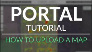
Next up in our Portal Tutorial Series of videos is our basic “how to” on creating your account and uploading your first map to our portal.
After you create a new account using your email, follow the steps in the video to upload and start working with your own Geospatial data.
Certain features such as elevation profiles and drainage analysis require 3D based data such as Digital Surface Models, or Digital Terrain Models.
Personal accounts allow users up to 5 different unique maps, with 3 layers (up to 200MB) allowed to be uploaded per map. Paid accounts allow more maps and layers to be uploaded, as well as larger file sizes (up to 1GB).
File Formats Supported:
Automatic Processing
- KML
- TIF
- SHP
Server Processing Required†
- LAS
- LAZ
- JPG
- ZIP
- XYZ
- CSV
†NOTE: Due to the fact the Green Aero Tech Portal is a Beta product, there are many other file types that may be functional but have not been fully tested.
- adani
- blockchain conference cleantech
- carbon
- carbon capture
- carbon footprint
- Carbon Sequestration
- carbon sequestration comapnies
- cleantech
- coingenius
- crypto conference cleantech
- dominion energy
- energy conservation
- Energy Consumption
- fossil fuels
- Green Aero Tech
- green energy
- green house gas emissions
- green mountain energy
- green power
- low carbon energies
- plato
- plato ai
- Plato Data Intelligence
- plato game
- PlatoData
- platogaming
- reducing emissions
- reliance industries
- solar energy
- solar panel
- sterling and wilson
- sw solar
- tutorial
- urban green space
- wind energy
- wind farms
- wind mills
- zephyrnet