The precision and usability of drone data today would have been seen as realistic only in a Mission Impossible movie 20 years ago.
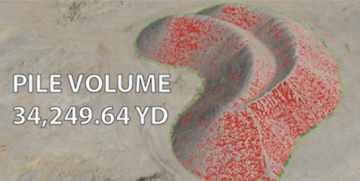
Mapping out an entire field in an hour to ±5cm degrees of vertical accuracy?!
Thermal imagery showing you where every trickle of water will run and how to move it?!
That is now possible. The tech is truly remarkable.
BUT, how are leaders in ag using drones AND how can MY OPERATION benefit?
Well first, in order to get results like a pro, you need three key things:
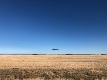
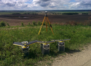
1. The drones themselves and survey equipment
2. The skills to use the tech and collect the data
3. Expertise in creating custom drainage solutions
In Green Aero Tech’s case, we take care of the first two.
That’s because the equipment can cost upwards of $50,000 and it takes months or years of training to use the gear effectively. Some operations can pull steps 1 and 2 off, but most can’t.
But that’s where we can pay you a visit and do all that work in an hour.
***REQUEST A FREE QUOTE IN THE NEXT 30 DAYS AND GET 30 ACRES OF MAPPING FREE***

For the third step, we partner with experts that help us plan and assist at each stage of the draining process.
It can be difficult to interpret and make a plan from the data yourself. But these experts will help you reap all the benefits of drone tech and manage your drainage like a pro.
And by doing so, there are a number of key benefits:
1. SAVE TIME AND MONEY: What once took a day or two, can now be done in an hour.
Mapping out your land manually is time-consuming, expensive and can damage your land. Fly over it instead.
Drone maps can even identify natural flow patterns on your land that often show only minor adjustments are needed for your drainage. That saves huge time and expense in taking out unnecessary mounds of dirt.
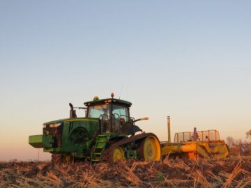
2. ACCURACY: We’ve all got the tractor stuck. It’s not fun. Drones report on every inch of your land, even the ones you can’t get to.
3. MORE MONEY: Say your crop yields you, on average, $10 per bushel. If you could start utilizing those 10 acres of previously downed out land, you’ll make an extra $4000.
And that’s just the start without even talking about inputs.
The bottom line: Whatever you end up investing to survey and map your land with drones, you’ll more than make back in saved time, money and new profits by being better able to use your land.
More and more farmers are using drones because it makes sense and is the next evolution in agriculture to maximize your land.
And whatever you invest to survey and map your land, you’ll more than make back in saved time and new profits.
Have questions? Check out Top 5 Most Common Questions for Using Drones to Save Money and Improve Water Management Blog.
OR REQUEST A QUOTE AND GET 30 ACRES OF DRONE MAPPING ABSOLUTELY FREE (ONLINE ONLY):
– Your friends at Green Aero Tech (1-888-845-4419)
- adani
- blockchain conference cleantech
- carbon
- carbon capture
- carbon footprint
- Carbon Sequestration
- carbon sequestration comapnies
- cleantech
- coingenius
- crypto conference cleantech
- dominion energy
- energy conservation
- Energy Consumption
- fossil fuels
- General FAQ's
- Green Aero Tech
- green energy
- green house gas emissions
- green mountain energy
- green power
- low carbon energies
- plato
- plato ai
- Plato Data Intelligence
- plato game
- PlatoData
- platogaming
- reducing emissions
- reliance industries
- solar energy
- solar panel
- sterling and wilson
- sw solar
- Uncategorized
- urban green space
- wind energy
- wind farms
- wind mills
- zephyrnet

